Los 4 mejores drones para cartografía en EE. UU. para 2026
Published on Friday, July 17, 2026
Los drones para cartografía son herramientas esenciales para crear mapas detallados y modelos 3D, utilizando sensores avanzados, procesamiento a bordo y software especializado. En EE. UU. se adoptan ampliamente en la agricultura, la construcción, la planificación urbana, el monitoreo ambiental y el levantamiento topográfico porque ofrecen datos de alta resolución más rápido y a menor costo que muchos métodos tradicionales. Los compradores priorizan la precisión (opciones RTK/PPK y LiDAR), la flexibilidad de sensores (RGB, multiespectral, térmico), la fiabilidad y la duración del vuelo, y la compatibilidad con ecosistemas de software para procesar fotogrametría o nubes de puntos. El cumplimiento regulatorio, la facilidad de uso y un sólido soporte posventa también son factores decisivos importantes para usuarios comerciales y agencias públicas al elegir un dron para cartografía.
Top Picks Summary
Parrot ANAFI Ai
El Parrot ANAFI Ai es un dron de última generación equipado con inteligencia artificial avanzada y conectividad 4G, que ofrece capacidades de captura de datos sin igual para el monitoreo agrícola. Su configuración de cámara única permite un zoom de 32x y vistas de gran angular, lo que permite a los agricultores analizar los cultivos con un nivel de detalle increíble mientras cubren grandes superficies de forma eficiente. El ANAFI Ai destaca por su diseño compacto, que facilita su transporte, y por sus soluciones en la nube para el procesamiento y compartición de datos. Este dron es una opción innovadora para profesionales que buscan optimizar sus flujos de trabajo agrícolas.
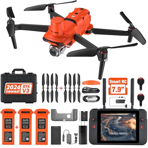
Autel Robotics EVO II Pro RTK
El Autel Robotics EVO II Pro RTK es reconocido por su avanzada tecnología RTK, que proporciona datos de geolocalización precisos para tareas de topografía y mapeo. Con una cámara 6K y un gran sensor de 1 pulgada, este dron ofrece una calidad de imagen excepcional y un rendimiento superior en condiciones de poca luz. Su notable tiempo de vuelo y sus interfaces fáciles de usar lo convierten en una opción principal para profesionales que buscan fiabilidad y simplicidad. La combinación de rendimiento y funciones del EVO II Pro RTK lo posiciona como un competidor destacado en el mercado de drones empresariales.
DJI Phantom 4 RTK
El DJI Phantom 4 RTK es un dron de alta precisión diseñado para las industrias de mapeo y topografía. Con un módulo RTK integrado, ofrece posicionamiento con precisión centimétrica, esencial para soluciones de cartografía de nivel profesional. La cámara de 20 MP, junto con varios modos de vuelo inteligentes, permite crear ortomosaicos detallados y modelos 3D. Confiable para profesionales, su fiabilidad y sus superiores capacidades de imagen lo convierten en un estándar de la industria.
Autel EVO II Pro RTK
El Autel EVO II Pro RTK es un competidor potente en el segmento de drones para cartografía y planificación urbana, gracias a su sensor de 1 pulgada y a sus capacidades de vídeo en 6K. Su avanzado módulo RTK proporciona una precisión excepcional, imprescindible para análisis urbanos detallados y trabajos de planificación. El diseño robusto del dron y su tiempo de vuelo prolongado aumentan su eficacia en escenarios de mapeo exigentes, ofreciendo a los planificadores las herramientas necesarias para lograr resultados precisos.
Lo que muestran las investigaciones sobre drones para cartografía
Un creciente cuerpo de investigaciones aplicadas e informes de agencias demuestra cómo el mapeo con drones mejora la precisión, reduce el tiempo de campo y permite nuevas decisiones basadas en datos en diversos sectores. Estudios de universidades y agencias gubernamentales muestran que los drones correctamente equipados pueden alcanzar resultados de calidad topográfica, permitir la detección temprana de estrés en cultivos, cartografiar infraestructura y recursos naturales con alta resolución, y reducir los costos y riesgos de seguridad asociados con los levantamientos tradicionales desde tierra o con aeronaves tripuladas.
Precisión: investigaciones y pruebas de campo muestran que los drones equipados con posicionamiento RTK o PPK y puntos de control debidamente verificados en terreno pueden ofrecer precisiones horizontales y verticales en el rango de centímetros bajos, adecuadas para usos catastrales, de ingeniería y construcción.
Velocidad y costo: múltiples estudios de caso indican que los levantamientos con drones reducen el tiempo de campo y el costo total del proyecto en comparación con métodos convencionales, especialmente en monitoreos repetitivos y en sitios grandes o de difícil acceso.
Agricultura y monitoreo de vegetación: estudios con sensores multiespectrales y térmicos demuestran una detección más temprana y precisa del estrés de cultivos, estrés hídrico y enfermedades que la inspección visual estándar, lo que permite intervenciones enfocadas y mejores rendimientos.
Topografía y forestal: los drones con LiDAR generan modelos digitales de elevación de alta resolución y métricas de estructura de la copa que apoyan el modelado de inundaciones, la estimación de biomasa y la evaluación de hábitats con mejor resolución que muchos conjuntos de datos satelitales.
Hallazgos sobre regulación y seguridad: la investigación sobre despliegues operativos destaca la importancia de pilotos capacitados, operación con línea de vista clara o exenciones aprobadas, y prácticas sólidas de gestión de datos para garantizar un uso seguro y conforme en espacios aéreos poblados o controlados.
Frequently Asked Questions
Which drone is best for professional surveying and mapping tasks?
The DJI Phantom 4 RTK is the preferred choice for professionals because it offers centimeter-level positioning accuracy and seamless integration with GIS software for reliable mapping results.
Does the Parrot ANAFI Ai feature high resolution camera capabilities?
The Parrot ANAFI Ai features a 4K HDR camera equipped with a 32x zoom capability, allowing for detailed data capture during agricultural monitoring missions.
How much does the Autel Robotics EVO II Pro RTK cost?
The Autel Robotics EVO II Pro RTK is priced at $2,999.00 USDwhich provides users with a 6K camera, a large 1-inch sensor, and advanced RTK technology for precise geolocation.
What is the average user rating for the DJI Phantom 4 RTK?
The DJI Phantom 4 RTK holds an average rating of 4.7, reflecting its status as a highly reliable tool for professionals requiring high-precision mapping and surveying functionality.
Conclusion
Los drones para cartografía se han vuelto indispensables en las industrias de EE. UU. donde los datos del sitio deben ser precisos, rápidos y repetibles. Esperamos que este resumen y las cuatro mejores opciones le ayuden a encontrar el dron de cartografía adecuado para sus proyectos. Si desea filtrar los resultados por tipo de carga útil, presupuesto, tiempo de vuelo o uso previsto, use la búsqueda para refinar o ampliar sus opciones.